
Trace a Street in Oklahoma
Use an address to find the parcel first, then follow each record on its own terms. Oklahoma has no single assessor portal for all 77 counties, and the county assessor’s card names an owner rather than every person who lives there. A map can connect an address with nearby parcels. Deed entries show legal transfers. Other records may offer household or voter clues, but none should be treated as a full street census.
- Confirm the county that holds the parcel. A mailing city or ZIP code may cross a county line.
- Search the county assessor by the full physical address, including its direction. If that fails, try a wildcard or subdivision, block, and lot.
- Open the parcel map and follow the road, clicking each relevant parcel to record its account, PIN, and legal description.
- Use the current owner and legal description to locate the deed history at the County Clerk or Recorder.
- For household clues, check eligible voter-file access and local reverse directories, while treating each as partial evidence.
That order keeps a useful search from turning into a claim the records cannot support. If a household member is the real subject, shift from a street-wide search to a name and date based check with the right custodian.
Oklahoma Assessor Search Fields
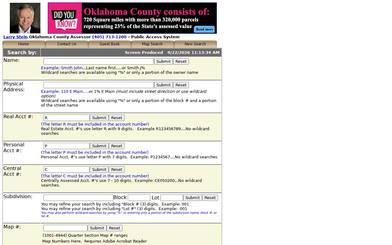
The inspected Oklahoma County Assessor search has distinct modes for a name, physical address, parcel account, subdivision, map number, deed book and page, and building or occupant name. It is one county’s working form, not a statewide standard. Each mode expects a different key, so note the exact field used when a search returns no result.
The captured form shows why a street number alone may not work. Its physical-address mode requires a direction or wildcard and accepts part of a block or street. Name mode expects last name first, and a percent sign can stand in for unknown letters. The street directory search fields below reflect the live Oklahoma County form inspected for this build.
| Search Field | Required | Format or Use |
|---|---|---|
| Name | Yes in name mode | Last name first; partial text and % wildcard accepted. |
| Physical Address | Yes in address mode | Include a direction or use a wildcard; partial block or street accepted. |
| Real Account Number | Yes in account mode | Ten characters, an R followed by nine digits. |
| Personal Account Number | Yes in account mode | Eight characters, a P followed by seven digits. |
| Subdivision, Block, Lot | Subdivision required | Search by plat name; block and lot refine the parcel. |
| Map Number | Yes in map mode | Four characters; the form links a quarter-section map PDF. |
| Deed Book and Page | Both together | Enter both values to locate a parcel record. |
| Occupant or Building Name | Yes in this mode | Partial or wildcard text; the office warns names may be stale. |
| City | Optional dropdown filter | Named cities, unincorporated, and Oklahoma County are listed. |
The search page’s transaction controls include tax years from 2000 through 2026, but that range is not a deed-book cutoff. It only describes the visible transaction filter. An older transfer may need the recorder’s index or a courthouse terminal.
The Oklahoma County Assessor search form pictured here shows its actual modes. Use it as a field reference, then check the selected county’s own site for its labels and limits.
A sample parcel card separates physical Location from Billing Address and lists owners, parcel PIN, City/State/ZIP, school system, tax district, value history, deed history, and permit history. It says the displayed legal description is not an official deed-transfer description.
| Sample card field | What it records |
|---|---|
| Location and Billing Address | Physical parcel address and separate notice address. |
| Owner names, account, and PIN | Listed owners and parcel identifiers. |
| Legal description and map links | Subdivision or section details with map and parcel links. |
| Value, exemptions, and sales | Assessment history and comparison records. |
| Deed history | Date, document type, book/page, price, grantor, and grantee. |
| Permit and building detail | Permit status, building description, year, area, and stories when present. |
Oklahoma Street Directory Records
An Oklahoma street directory combines records that are kept for separate public purposes. A county assessor lists parcel ownership and tax facts. The GIS map connects parcels on the ground. The County Clerk or Recorder holds recorded instruments, while a Treasurer tracks tax payments. Planning or code offices may hold permit records by address. Each source answers a narrow question, and the access route varies by county or city.
| Record Set | Keeper | What It Shows | Access |
|---|---|---|---|
| Assessor parcel card | County assessor | Owner, physical and billing address, PIN, legal description, value, exemptions | County portal, phone, or counter |
| Parcel map | County GIS or assessor | Parcel shape, adjacent lots, map link, available district layers | Interactive county map |
| Deed or lien | County Clerk or Recorder | Grantor, grantee, date, book/page, price, legal description | Recorder portal, terminal, copy request |
| Tax account | County Treasurer | Payment, delinquency, or resale information | Treasurer portal or counter |
| Permit or code file | City or county office | Work, permit date, applicant, or case status when recorded | Local portal or records request |
| Voter record | State or County Election Board | Registration address if available under access rules | Self-verification or approved EDW request |
| Reverse directory | OHS or local library | Historical person or household listed at an address | Catalog, onsite holdings, or library service |
Link the sources through stable details. A parcel account or PIN points to the map; the legal description ties the parcel to a deed; a book and page help retrieve the instrument. The physical address joins the map and local permit file, but the billing address may point elsewhere. A voter record can confirm a registered address only when the user qualifies for that access and the address is not protected.
Map an Oklahoma Street Parcel by Parcel
On an Oklahoma County parcel card, the Parcel Map button opens an ArcGIS view keyed to that account. A user can pan along a street, select an adjacent lot, and open the account tied to that map feature. The county GIS hub also links to parcel data and other public layers. Exact layer names can change, so record what the live map shows instead of assuming every county uses the same set.
A map is useful for seeing where a street crosses a parcel edge, school system, or tax district. It can also point to a second county assessor when a road runs beyond the first county’s jurisdiction. The map polygon is not a deed, and the assessor’s card is not a survey. For a legal boundary, follow the parcel’s recorded description and instrument at the County Clerk.
The inspected example is the Oklahoma County parcel map, linked from the assessor’s card. Its GIS hub lists map and data entry points.
Oklahoma Street Boundaries Cross Counties
A ZIP code or mailing city does not tell you which County Clerk holds a deed. Oklahoma’s 77 county assessor systems are separate, and a boundary road can place nearby parcels under different custodians. Oklahoma County’s no-result notice directs some searches toward Logan, Canadian, Pottawatomie, or Cleveland County. Use the map or county boundary source to settle jurisdiction before deciding that an address has no record.
This geography is one reason a statewide street directory cannot be a single searchable assessor list. County forms use different vendors and fields. If a street continues beyond a line, repeat the address search in the next county’s official assessor and Clerk systems, then compare legal descriptions rather than relying on the mailing city alone.
Read an Oklahoma Street Deed Chain
After identifying a parcel, use its current owner and legal description to reach the Clerk’s land records. The deed chain runs through grantor and grantee names: the grantor conveys an interest, and the grantee receives it. Search the latest grantee as a prior grantor or the earlier seller as a grantee, then check that the legal description still fits the same parcel. Name matches alone are weak because people can share a name or appear under a trust, business, initial, or changed surname.
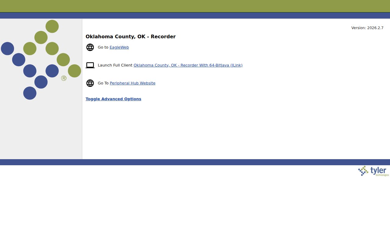
The Oklahoma County Recorder’s EagleWeb page launches the county deed index and reports version 2026.2.7. The captured image shows the browser launch screen; live search and instrument access may depend on the portal’s JavaScript and cookie settings.
The assessor sample’s deed rows include date, document type, book, page, price, grantor, and grantee, with links to recorded instruments. If an online index stops or omits an image, contact the County Clerk, use the courthouse public terminal, or ask about a paper or electronic copy. Fees and online coverage vary by county.
Oklahoma Street Permits and Work
Permit and code records can add dates to a parcel history. The inspected assessor sample linked a building-permit history with issue date, permit number, provider, building number, work description, estimated construction cost, and status; that parcel returned no permit rows. Absence from one card does not prove that no work took place. A city or county planning office may hold a separate address-based file.
Use a permit to learn when a recorded project was filed and what the entry says. It does not establish who lived at the property at that time. Ask the local planning or code office for its address search and request process if its records are not online. A County Treasurer’s tax balance answers another question, so do not treat assessed value as proof of tax payment.
Older Oklahoma Street Names
Old address searches can fail because the words changed, not because the record is missing. The Oklahoma Historical Society’s home-history guide warns that older newspapers may spell a street number and direction as “twelfth” and “northwest,” while a later index uses 12th and NW. Search both forms, the subdivision name, lot and block, and nearby cross streets. Oklahoma has no single statewide year for street renumbering or renaming; the research needs to be checked town by town with planning records, old plats, directories, or Sanborn maps.
Keep the record’s own spelling in notes, then add a current form for the next search. A street directory can use one label while the legal parcel still follows a plat or a section-township-range description.
- Parcel
- A tract of land tracked under an assessor account or parcel identifier.
- Situs address
- The physical location of the parcel, distinct from its billing address.
- Plat
- A recorded map that names lots, blocks, streets, and subdivision lines.
- Criss-cross directory
- A directory organized by address, useful when a household name is not known.
Oklahoma Voter Records by Street
The public OK Voter Portal is designed for a voter to check their own registration, not for an open street-by-street browse. It asks for the name as it appears on the registration and date of birth, with more verification for some services. The portal also supports tasks such as an address change, sample ballot, polling place, districts, and voter ID replacement.
Oklahoma’s Election Data Warehouse offers basic and full access through different request forms. Effective November 1, 2025, full-list access is limited under 26 O.S. §7-103.2 to specified eligible users, including bona fide Oklahoma resident U.S. citizens, recognized party representatives, candidates or their representatives, and others authorized by law. Approved full-file users receive CSV data refreshed each weeknight and must sort it themselves; the Election Board does not create a custom street list. Basic access does not include the voter registration list.
The State Election Board’s access page says protected addresses are excluded. Phone, email, driver-license, and Social Security numbers are not part of the released registration record, and ballot choices are never disclosed.
Limits of an Oklahoma Street Directory
Public land records identify parcels and recorded parties, not everyone in a household. A deed grantee may never have lived at the address, and a building or occupant label in an assessor system can be stale. A voter record can be hidden for a protected person and does not show every adult at a home. Motor-vehicle addresses are restricted by the federal Driver’s Privacy Protection Act, and utility customer or delivery lists are not public resident rolls.
Lawful use. Use Oklahoma address records for family history, property research, and other lawful personal purposes. A public record is not permission to follow, threaten, impersonate, or harass a person.